 |
|
|
|
||
NewsJune 2023On 30 June at 7 pm, Dr. Jörn Wichert gave a public lecture at the Staatsbibliothek zu Berlin, Preußischer Kulturbesitz. In this lecture, the project was presented to a broad audience. Rock fall on the road from Ushguli to Mestia, between Ushguli and Dawberi
May 2023In May, a major meeting took place between various project partners with the Georgian Ministry of Environment and the associated technical authority NEA as well as the mayor of Mestia. The project and a monitoring system for the village of Zabeshi prepared by HTW Dresden and EAS Dresden were presented and discussed. It is to be developed as a prototype to provide cost-effective monitoring for other regions in Georgia. Cooperation possibilities were also discussed and it was agreed that Dr. Jörn Wichert would work on various topics. 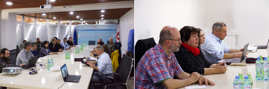
Discussion with members of the Georgian Ministry of Environment and the associated professional authority NEA
Subsequently, drone flights and further mapping were carried out in Upper Svetia. It was agreed with the city of Mestia that they would take over the maintenance of the gateways and weather stations after the project. 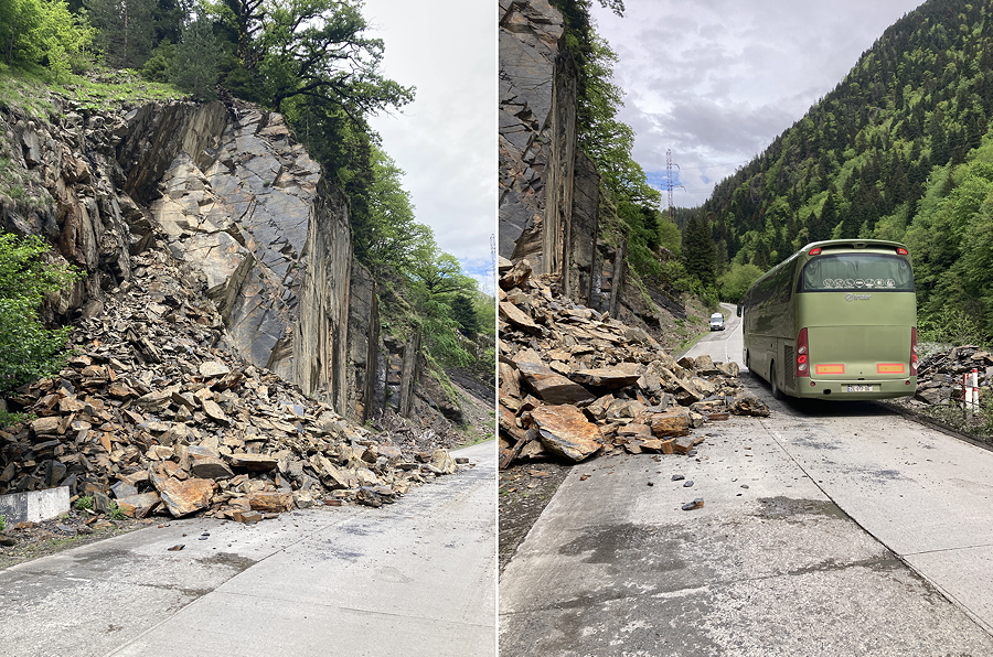
Landslide along the road to Mestia
With the drone flights, geometric 3D models of rock slopes (see photo) and debris flows are generated. This gives us an overview of the bedding conditions and we measure interfaces with the free software "CloudCompare". 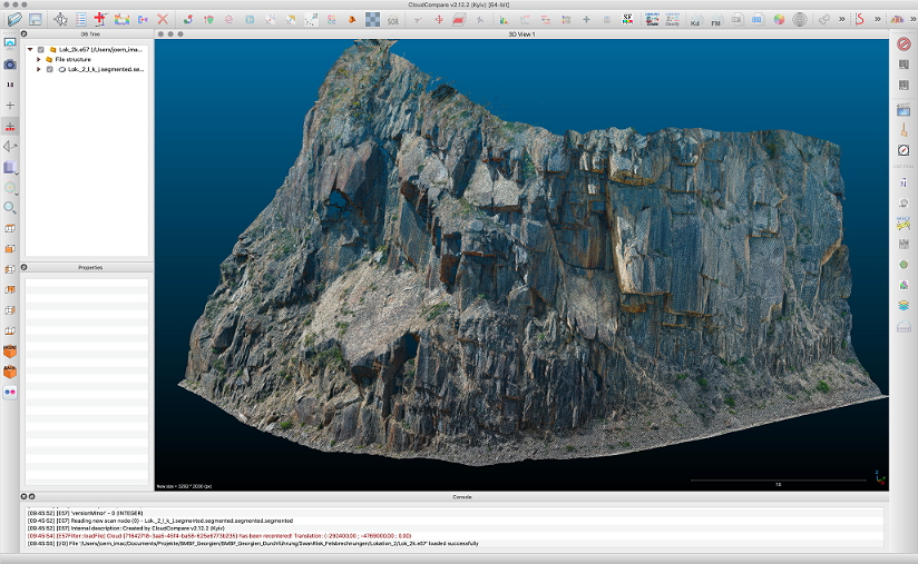
Drone-generated 3d model of a rock slope.
März 2023In March, Dr Jörn Wichert presented the project in Tbilisi to the Georgian Ministry of the Environment and the associated technical authority NEA. The mayor of Mestia was also present. The reason for the presentation was the high risk to the village of Zabeshi. It was proposed to install a monitoring system for the debris flow in question as soon as possible. The Ministry proposed a larger meeting in the spring.
November – Dezember 2022
In November, aeroDCS GmbH carried out new drone flights over the debris flows in Lenjeri and Zabeshi, which clearly demonstrate the movements and material relocations in the upper areas.
Oktober 2022
This month, together with EA Systems Dresden, we configured the monitoring system on the software side and made some improvements for data transmission.
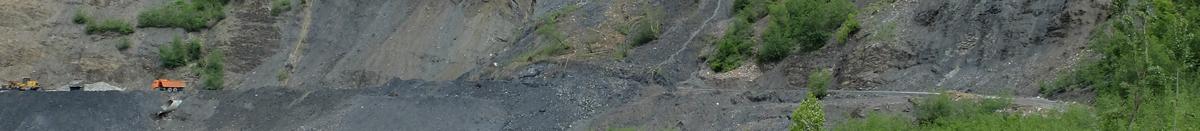
Landslide on the road from Ushguli to Mestia, between Ushguli and Dawberi in October 2022
August - September 2022
In spring and summer we mapped selected rock areas geologically and flew them with drones by aeroDCS GmbH in order to generate geotechnical models. 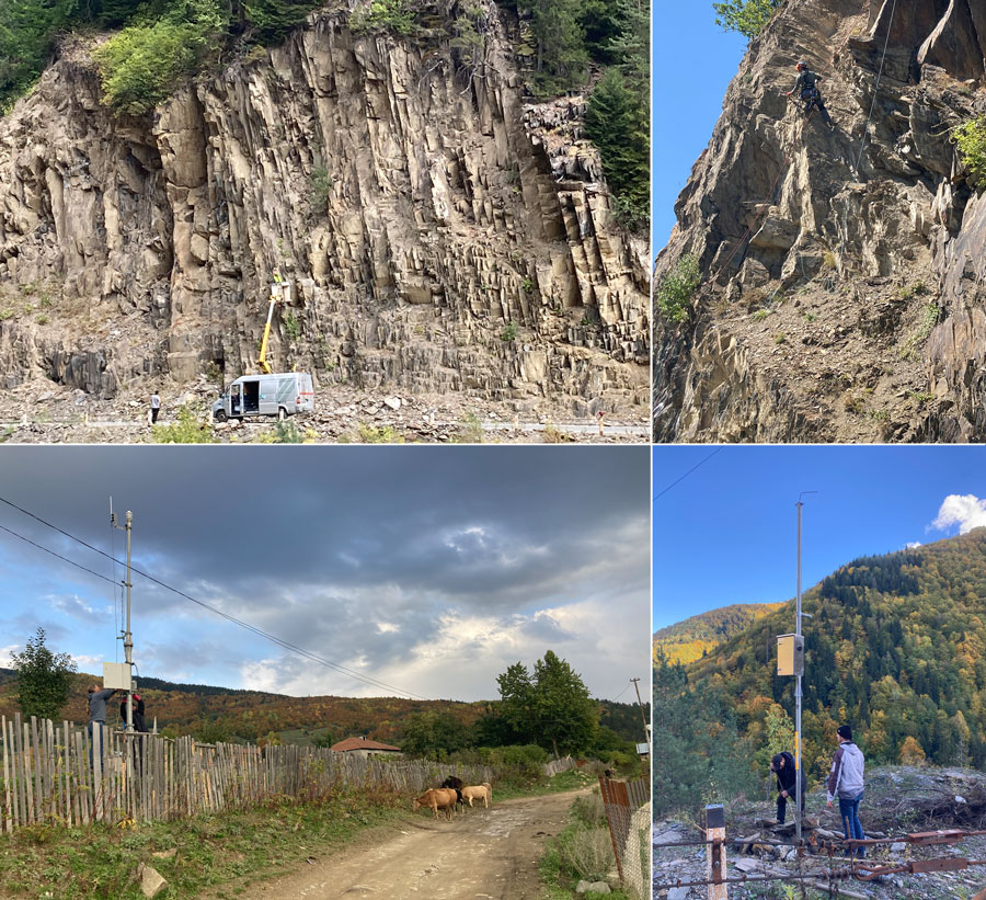
Upper photos: Installation of sensors by R. Reichelt; Below left: Weather station in Etseri; Below right: Installation of a gateway for monitoring
Mai-Juni 2022
In April, we were invited to attend the final conference of the Damast project, where we could present our project. The colleagues from KIT (Karlsruhe Institute of Technology) work within the area of the Enguri Dam and therefore they are our "neighbours". We have agreed to work together in Svaneti with regard to their follow-up project and try to support each other. 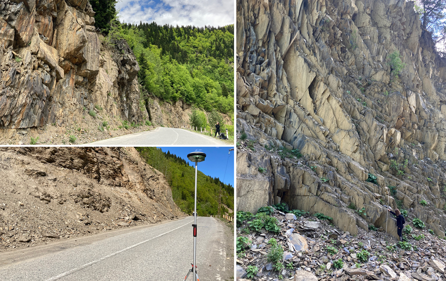
Engineering-geological investigations of slope in the Enguri valley
At two localities with slate slopes, drone flights and terrestrial surveys were carried out by Aero-DCS in order to subsequently generate geometric 3d models.
At the same time, the two staff members of the TU Bergakademie Freiberg carried out an engineering geological mapping of these localities.
The slopes consist mainly of slate, which is very often so heavily fissured that both the geological terrain work and the installation are sometimes very dangerous.
At the moment we expect the installation to take place next July and August and the plan is to install the sensors using platform truck. During our stay, we were able to test the Georisk app on site so that the company Dassau Geoinformatik could still make improvements. This mainly concerns the transfer of the reports to our server and the subsequent display in the GIS.
November 2021
This month, the final locations of the weather station were decided. For Ushguli, the installation is planned at the school. We want to involve the students in our activities, i.e. explain what we do and give them access to the weather data. The aim is to build on this to create an interest in the topic of natural risks or in science and engineering. 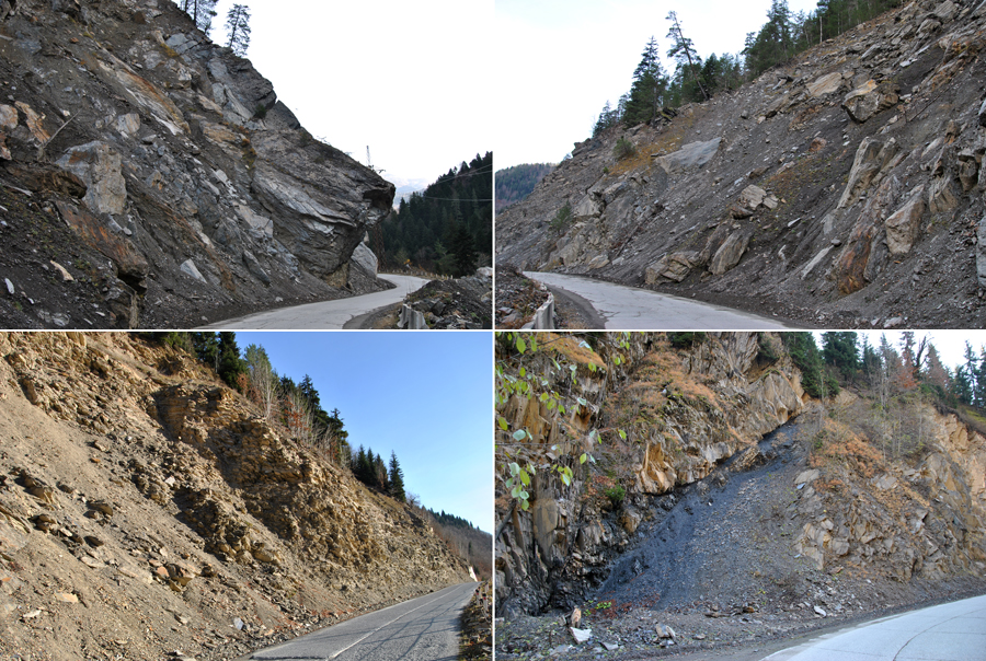
Slopes in the Enguri valley
We also talked to the mayor about the possibility of building gabions to secure the slopes on site. On the one hand, this would create income opportunities and on the other hand, the debris from the debris flows could be used. We will draw up the technical requirements for this and determine the approximate investment costs, while the Georgian partners will look into possible financing from the Georgian side.
October 2021We are preparing the field investigations for November. Here, among other things, we will discuss the creation of safety concepts on selected rock slopes. The weather stations are also to be installed and put into operation in the course of November. 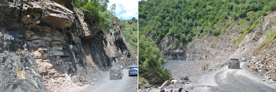
Road from Mestia to Ushguli
August 2021During the two-week stay, we discussed the concrete work and study areas with the governors of Upper Swanetia and Mingrelia as well as local mayors. Furthermore, we explained our project to the inhabitants in various villages. They were very grateful and offered us their support. 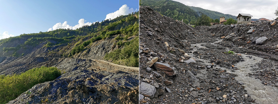
"Black Channel" Zabeshi (left) and debris flow in Lendjeri (right) After the joint inspection of the first selected localities, surveys and drone flights were carried out. These serve as the basis for generating digital terrain models, which are the prerequisite for calculations and modelling of mass movements. For the calculations, sample material was taken from two debris flows in order to analyse the soil mechanical parameters in the laboratory at the HTW Dresden. Within the framework of the field investigations, it was decided to install a first monitoring and early warning system in Lendjeri in the course of the next six months. Currently, the concrete design of the system is in progress. Furthermore, the points for the installation of the weather stations were determined. 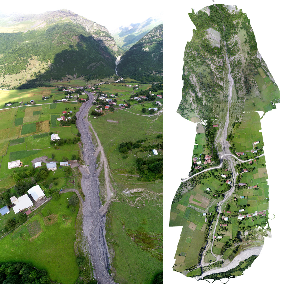
Drone images of debris flow in Lendjeri (left) and Zabeshi (right)
|
||